
My first Esri UC
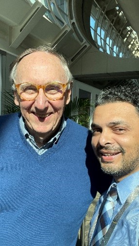
This was my first time attending the Esri GIS UC in person which took place between July 11 to 15, 2022, in San Diego, California. I was extremely fortunate to meet my GIS Hero, Jack Dangermond, who started Esri inc. in 1969. With over 800 sessions and almost 15,000 participants, I could not have imagined the grandeur of this event. All of the sessions within the conference took place in-person and live recordings were broadcasted on their website to more than 16,000 participants worldwide. Every session I attended provided immense knowledge, tools, tips, and practical applications that I can immediately use for our clients in Suriname.
Climate change and GIS
The plenary session led by Jack Dangermond featured special guests such as the FEMA Director, Deanne Crisswell, and Climate Change specialist in the White House Climate Policy Office of President Biden of the USA, David J. Hayes. Hayes’ proposition is:
“Geospatial mapping tools may be the most important weapon we have to fight against climate change.”

FEMA Director Deanne Criswell message is: “We have to start to embrace the fact that our world is changing around us, and we have to be able to use this (GIS) type of technology to help us plan for the future. This type of predictive data has never been more important to help our emergency management community get ahead of the threats that we are going to face in the future.”

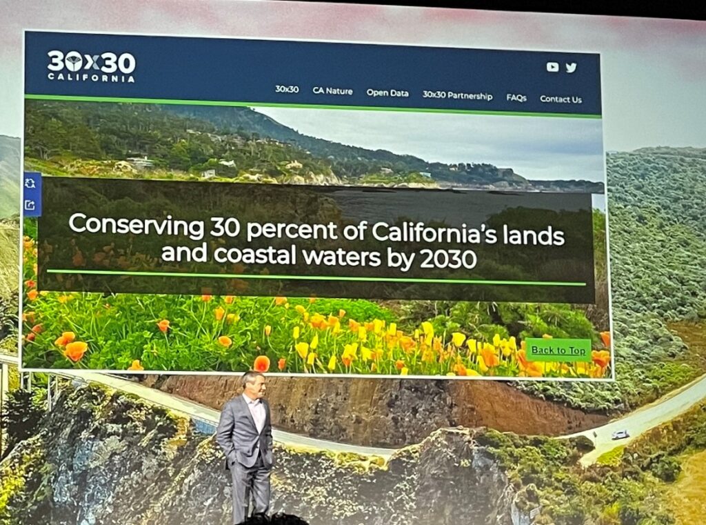
California Secretary for Natural Resources, Wade Crowfoot and Nathaniel Roth talked about and demonstrated how they realize conserving 30 percent of California’s lands and coastal waters by 2030.
NASA goes to MARS, and ESRI goes to the deepest point on Earth.
We got to see firsthand the results of Esri’s esteemed oceanographer and chief scientist, Dawn Wright, who made a historic visit to the deepest point of the ocean. She descended 11 kilometers into the Mariana Trench, the deepest point on the Earth. Dawn is the first woman of African descent to have embarked on this historic voyage.
We have maps of Mars and our Moon that are more complete and more detailed than our ocean maps. Dawn’s work on taking climate action focuses on mapping the ocean. To date, only 23.4% of the ocean floor is mapped to modern standards. The Seabed 2030 project aims to fill the map with high-resolution data by the end of the decade.

About Esri
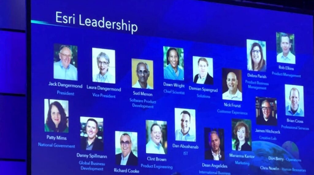
The Environmental Research Systems Institute Inc. (Esri) company was founded in 1969 by Jack and Laura Dangermond.
Esri Geographical Information System (GIS) User Conference (UC) has been recurring for the past 42 years. The first Esri UC started with 11 people and has grown to 14,994 people physically in San Diego, California and another 16,596 people live online. Esri Inc. is the world leader in providing Geographical Information System (GIS) solutions. Esri’s ArcGIS platform is the most advanced GIS solution worldwide.
GIS- Mapping for Common Ground
Mapping is a fundamental language for telling stories about our world. Helping us understand and collaborate by visualizing, organizing, abstracting, communicating, planning, envisioning, analyzing, problem-solving, evaluating, and acting. GIS Professionals worldwide and in Suriname are already mapping common ground.
Mapping all the relevant factors, creating understanding, and facilitating collaboration. Maps give insights, lead to actions, and result in:
- Reducing violence
- Prioritizing investments
- Conservation planning
- Applying science
- Finding equitable outcomes
- Addressing drug addiction
- Organizing communities
- Planning for sustainability
- Community planning
- Siting renewable energy
- Managing resources
- Resolving conflicts
- Environmental assessment helping homeless
The ArcGIS platform supports GIS professionals and organizations. It is a content-sharing platform. ArcGIS has numerous solutions for use cases from real-time field data collection, behind the desk processing to engagement, analytics, and insights. ArcGIS Survey123, ArcGIS Field Maps, and ArcGIS Drone Site Scan is a Software as a Service (SaaS) solution to collect data offline or in real-time online on mobile devices or browsers. All data collected can be processed and enriched in ArcGIS Web Apps, which in turn can be shared via real-time ArcGIS Dashboards, Hub, or native mobile apps. All these cloud SaaS solutions are seamlessly connected. It is possible to deploy on-premise with Enterprise solutions.
Other powerful ArcGIS software solutions are:
- ArcGIS Indoor with Indoor Positioning System (IPS)
- ArcGIS for Microsoft 365 seamlessly integrates geospatial tools and maps with Excel, SharePoint, MS Teams, PowerPoint, MS Power BI, and Power Automate
- ArcGIS Apps for building native iOS and Android apps
- ArcGIS Pro, replacing ArcGIS Desktop ArcMap for advanced geospatial editing, analyses, and publishing
- ArcGIS Image Analyst for satellite imagery analysis
- ArcGIS Hub for building portals containing all your web maps and apps
- ArcGIS Experience Builder to create custom widgets and more functionality for your web map apps
- ArcGIS Insights for analytics of structured and unstructured geo-data
- ArcGIS Knowledge Graph to create non-spatial models that simulate a real-world system
- ArcGIS Survey123 with its new feature of real-time Vertex Streaming makes field tracking more effective

Interesting statements
- More than a map, it’s not what you see, it’s what you can do with what you see
- Analysis starts and ends with data
- The world isn’t flat, neither is your data
- Data always has spatial component
Interesting facts & stats about Esri UC
- 14,994 physical attendees
- 16,596 digital attendees
- 31,590 total Esri UC 2022 participants
- 2,100 Esri Staff
- 142 countries
- 200+ exhibitors
- 225 technical workshops
- 58 Special Interest Groups
- 196 User Presentations
- 192 Demo Theaters
- 50 Expo Spotlight Talks